14 Aug
Broome, a day of contrasts.
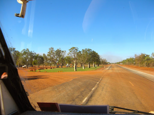
Up early for the final boring 100km to Broome (after all the excitement of a desert crossing), where we attacked the Coles supermarket, the first we’d seen since Halls Creek and even that wasn’t all that flash.
We were also slowly getting used to being on our own again after 2 weeks in the company of 2 other Okas and 4 other travelling companions. You get used to seeing people in front or behind (or even to the side) knocking over trees and bouncing over spinifex clumps or chatting on the CB, and then suddenly it’s all quiet again but with a lot of busy highway traffic. We now have to used turn signals again and check in the rear view mirror for high speed road trains.
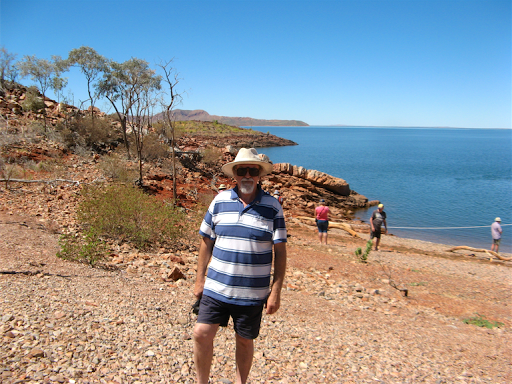
But before we reached Broome, knowing that finding accommodation can be a real pain there, we checked into the Broome’s Gateway, an all non-powered, camping and caravan emporium about 20 mins east of Broome, for a couple of days. $27 a night off which we got a return visitor discount of 10% since we stayed here for 2 days a couple of years ago, they had us on their computer. It’s a nice bush location 20km from Broome with wide sandy tracks and sites, uncrowded and with plenty of water and space.
And then it happened, problème du jour #1. When we pulled up at the Gateway, I switched off the engine and there was an explosion of noise and water from under the kitchen sink in the rear. I’d fitted a relay which inhibits the water pumps while driving, so if a leak happens the pumps wouldn’t come on and empty the tanks all over the road without us knowing. Today they emptied the tanks all over the floor of the Oka instead. I quickly sussed out that the problem was a valve, which I’d fitted to connect the drinking water supply to the domestic supply in an emergency, had failed (and ironically creating an emergency), allowing both pumps to spill their guts out, so to speak.
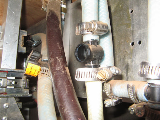
A simple enough problem to solve, if you have a replacement valve or a couple of plugs to block up the pipes, but I had no spare valve easily to hand without dismantling something else and only one plug. I couldn’t locate anything else that would fit, I tried clamping bolts in the pipes, bending the pipes over, jamming in a stick whittled by Janet and even an AA battery (rechargeable). None of them stopped the water flow so I disabled both pumps and made the Mitre 10 store in Broome our first call, to buy up their entire stocks of plumbing components. A few minutes later and it was all fixed.
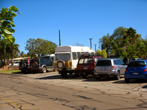
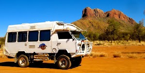
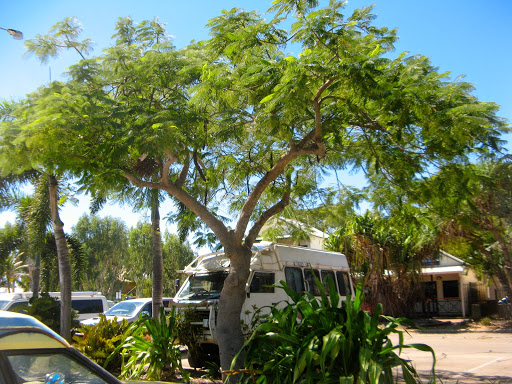
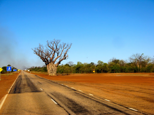
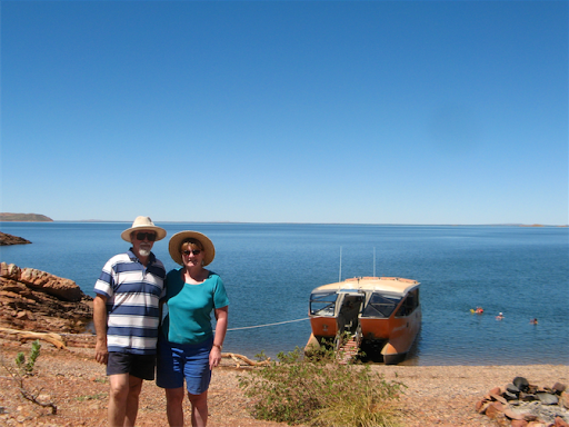
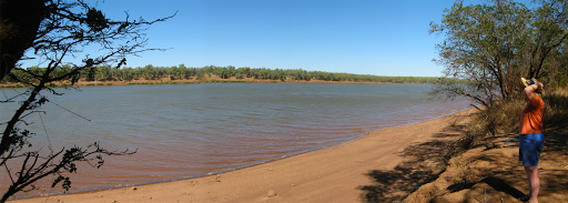
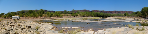
Our Oka parked in the middle of Broome:
Only then could we attack the Coles supermarket. Coles was well stocked and not as expensive as it could have been, given the remote location. We held off buying meat and some other purchases to give us another fuel discount voucher for tomorrow. Fuel at $1.75/l was much cheaper than any other local town (mostly $1.98/l).
There was another aspect to shopping in Coles that I never thought I’d see outside of movies and comedy shows, a young lady with her skirt actually caught up in her knickers, a bit like this actually:

Janet was all for telling her but I said why ruin a perfect day? Anyway she’d probably blurt out “my husband noticed... etc. etc.”.
Then we found problème du jour #2. While we were driving around Broome, I thought the steering felt a but lumpy, and when I checked, the front RHS tyre looked very soft, which was confirmed by an actual measurement of 25PSI. This was the tyre that went flat in the GSD which we plugged with 2 plugs on the track and it saw out the remainder of the trip OK.
So we pumped it up and wallowed down to Broome Port where we replaced the wheel on firm bitumen in the shade of a huge oil tank. The replacement tyre is much better, it runs smoother and is better balanced as well. The soft tyre was leaking around the plugs after several days of rugged desert travel so I inserted a 3rd plug and it seems to be holding, but it will only be an emergency spare, pending getting it professionally fixed. I was glad it had gone down here, not on the highway where it might have burst ahead of a very large road train…
After the rigours of replacing a wheel in the heat, we sauntered around the port area and up the still corrugated sandy track to Gantheaume Point for the usual sunset photos, then back to the campsite for steak and salad.

At the port we spied this strange vehicle. What could it be?
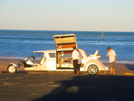
It turned out to be a Limo Trike which you can hire an $295 an hour for specialised cruises around Broome:
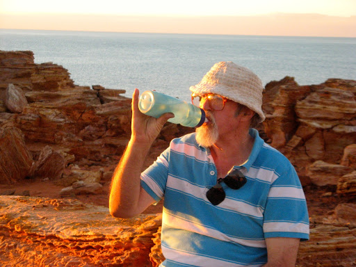
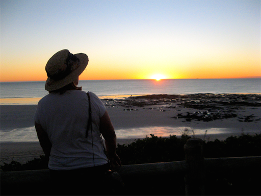
Me having a cool drink (not champagne) at Gantheaume Point:
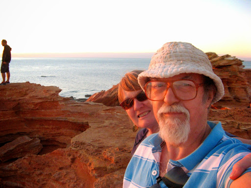
While waiting for the sun to set:
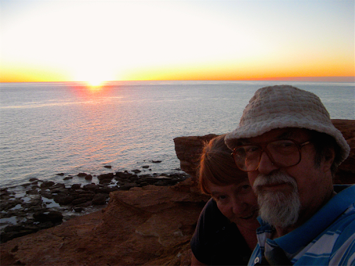
And it did:
Now just the leaking water tank to repair when we get somewhere soft and warm and not windy. It’s been blowing an easterly gale for several days now, mostly during the day, which makes working outside very frustrating, even if it is warm.
And just to complete the trilogy of water problems, I had to fix problème du jour #3. Our drinking water pump has slowed to a crawl so I bought and replaced the 0.5 micron filter element from the smallest Bunnings store I’ve ever seen, only about twice the size of my shed but surprisingly well stocked.
15 Aug
Today’s forecast temperature is 29, but it’s only about 14 at the moment and very chilly when you’re dressed for 29 and it’s very windy too.
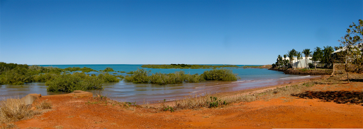
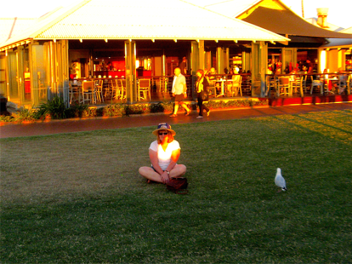
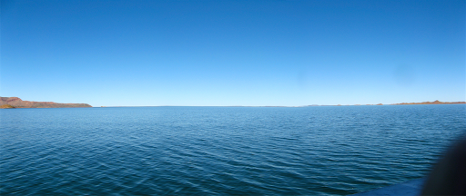
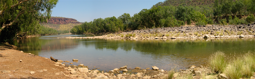
Lunch spot at Roebuck Bay, Broome at high tide:
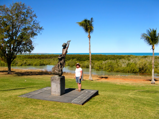
While having lunch at Roebuck Bay we spotted a few other interesting things.
A statue of a lady with concrete boobs, commemorating the contribution of women to the development of the pearling industry in the Broome area. Presumably the pearl shaped boobs contributed to this contribution in some way:
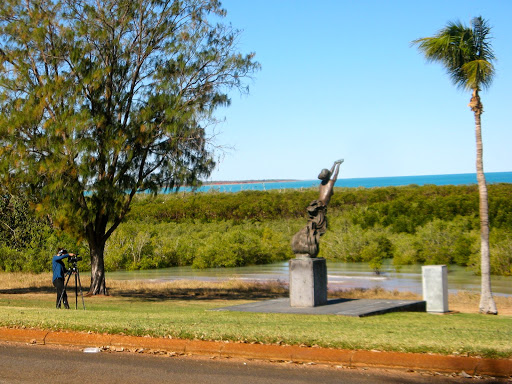
And I was not alone in photographing these contributions;
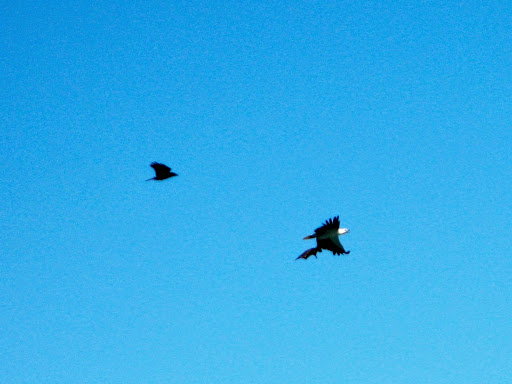
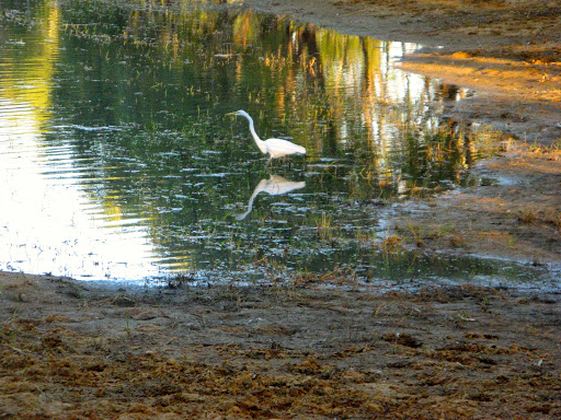
And a sea eagle which had caught a bat which carelessly left it’s mangrove roost in the middle of the day:
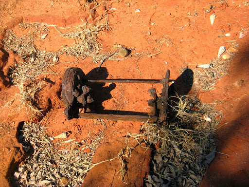
A rusty push lawnmower on the beach:
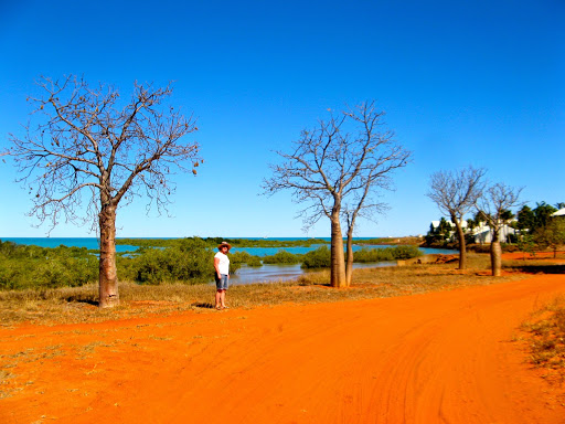
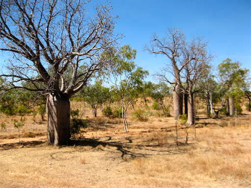
Boabs overlooking the bay:
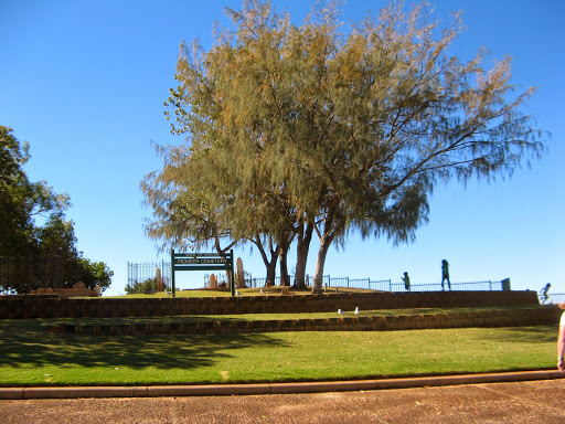
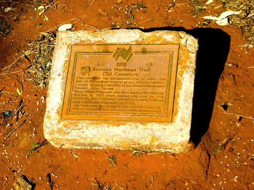
The Pioneer Cemetery at Broome’s Town Beach:
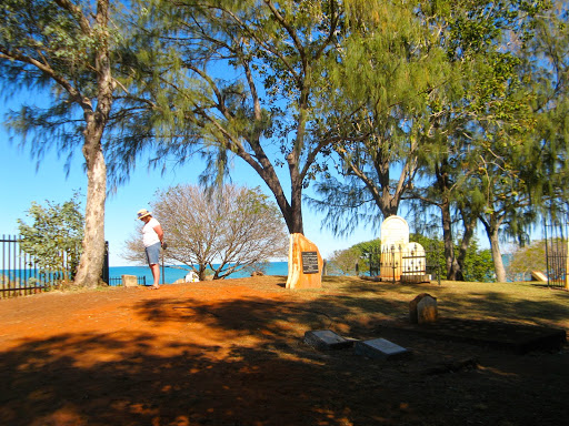
It looks very much like a western Boot Hill:
It also commemorates the 70 people killed in Japanese bombing raids on flying boats laying at anchor in Roebuck Bay in March 1942. We were fortunate to visit the wrecks of the Catalinas on a hovercraft trip at very low tide in 2007. They were full of civilians being evacuated from Indonesia.
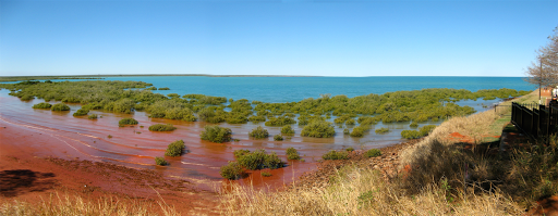
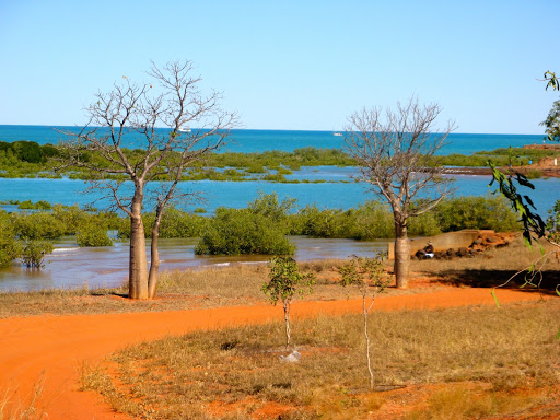
Roebuck Bay at high tide:
Our Oka parked under a bean tree in Broome:
Later in the afternoon we dawdled up to Cable Beach for the sunset, as one does.
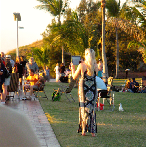
How to take a Cable Beach photo, iPad style:
Waiting for sunset on Cable Beach:

And here it is, more bloody photons and wasted pixels, but for some reason everybody does it:
16 Aug
Leaving Broome today and heading east, but first we went back into Broome for the Saturday Markets in the grounds of old Courthouse.
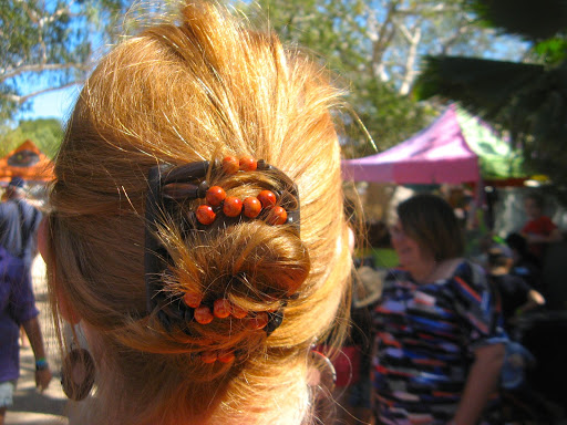
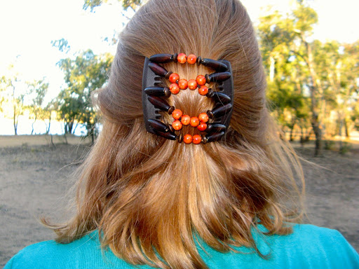
Janet bought a “thing” for her hair:
And I found a few other things of interest:
Yeah right.
If only I could find someone to apply this to me:
No idea what these are:
The new way to protect your mouth from UV rays:
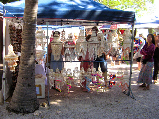
Lots of hangy things made of shells:
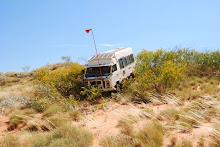
On the way from Broome towards Fitzroy Crossing we passed this Oka, they waved but we didn’t recognise it or them.

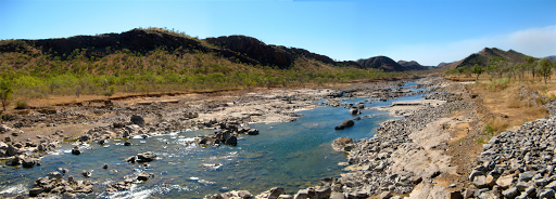
Crossing the Fitzroy river:
Boabs at Wellare Bridge:
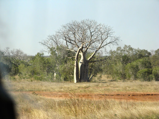
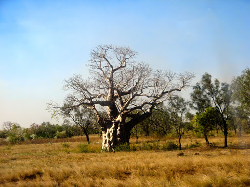
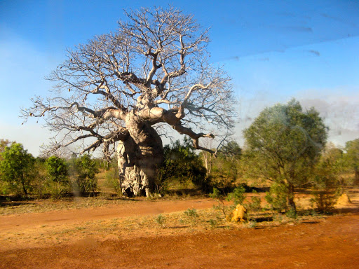
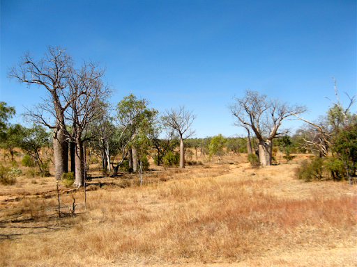
More huge boabs along the roadside;
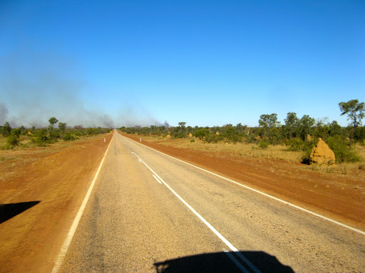
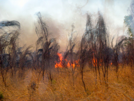
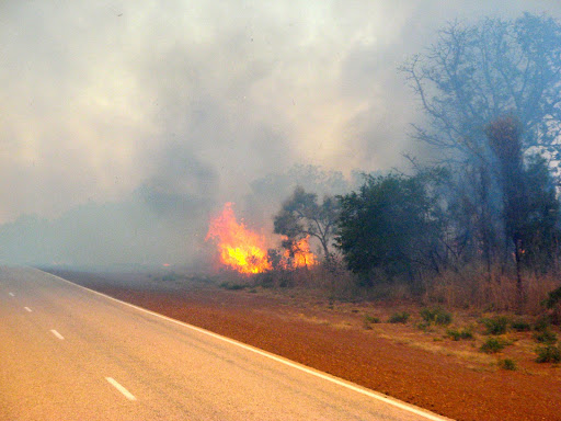
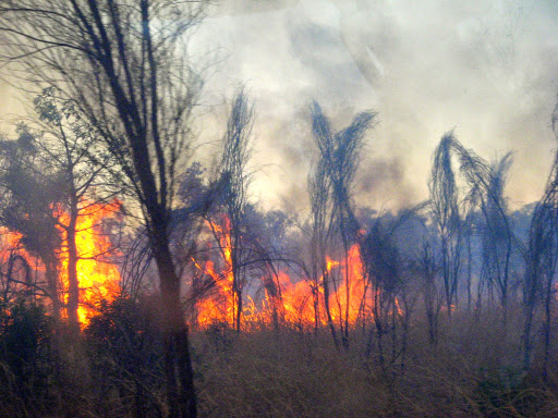
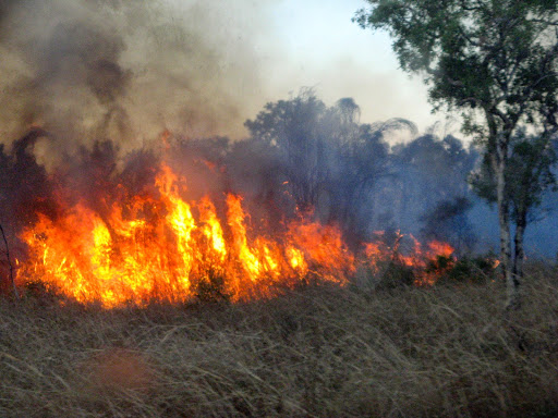
Smoke started appearing on the horizon:
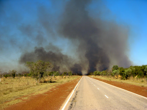
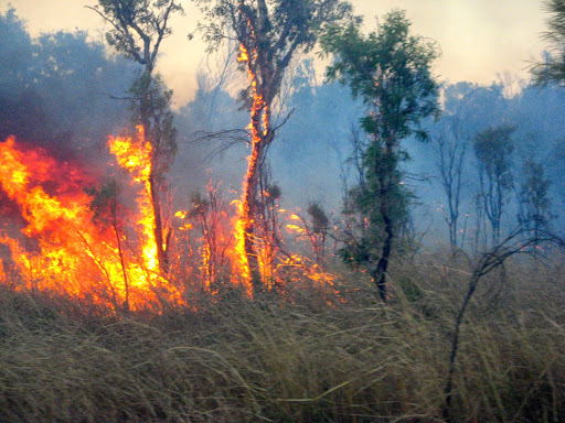
And soon we were approaching the Gates of Hell:
Video of us passing through the Gates of Hell:
The Gates of Hell from David and Janet on Vimeo.
17 Aug
4 weeks since we set out, it seems a lot longer considering what we have done over those 4 weeks.
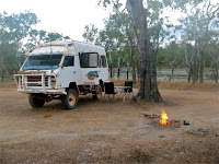
Last night we camped in a gravel scrape alongside the road, only 3km from a rest area, although we didn’t know that of course. Anyway our spot was nice and secluded and we had it all to ourselves, not jostling amongst caravans.
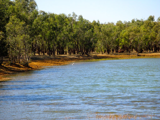
We had only done 70km today when we passed “The Lake”, a large rectangular man-made dam for watering stock. But it’s also a camping area with access allowed by the station owners and quite nice so we went in for a look and stayed all day to do some maintenance.
I took our leaking water tank out and eventually discovered a small hole in the PVC bladder. I’ll need some PVC cement from the next hardware store to fix it.
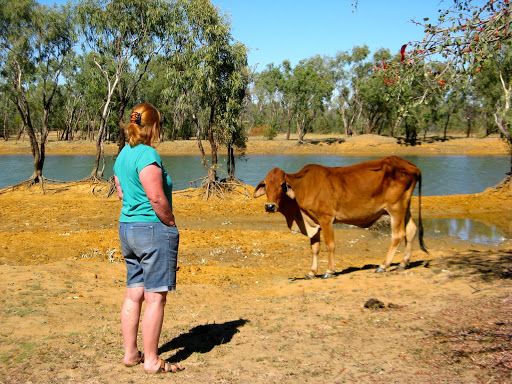


We needed some washing done so we used the lake water…
and so did the local wildlife:
18 Aug
From our quite nice Lake campsite we trundled down to Fitzroy Crossing for some water and hardware supplies.
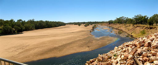
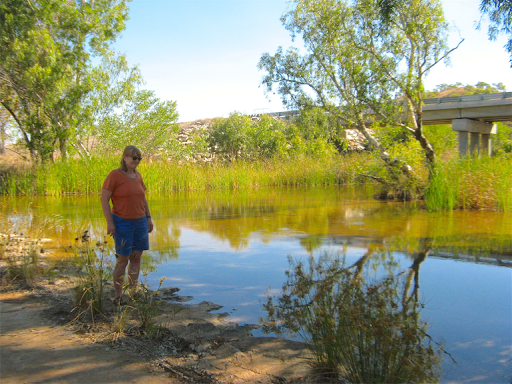
The Fitzroy River was wide and still, unlike the wet season.
The FC Visitor Centre was far from friendly. We asked if we could use their tap to top up our water tanks and the young lady said, “normally yes, but someone has stolen our tap top so we can’t turn it on.”
So being an engineer, I went outside and turned it on with my pliers and topped up our tank. However, that was apparently all wrong, Ms boss lady came out and said “you shouldn't be doing that, you might damage the tap and then I'd have to get a new one which will cost me money".
Too late by then though, we already had our 50 l, but I had asked first. It wasn't a very welcoming start to our FC visit, which then lasted only as long as a trip to the very helpful hardware store for a vinyl patch for a small hole in our flexible water tank.
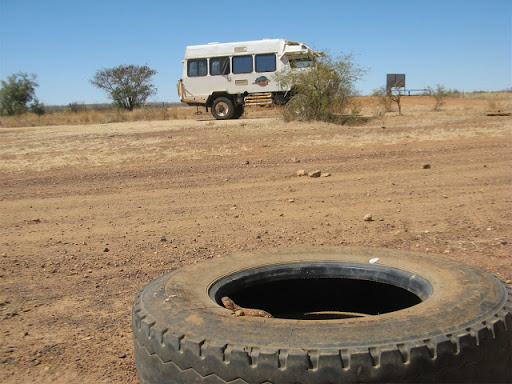
Later we stopped for lunch at the very place where we had met up with Dave and Pauline only a few weeks ago at the start of our desert crossing, and met this very friendly lizard that had made his home in an old tyre:
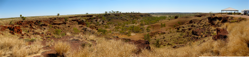
The breakaways from the Ngumpan Rest Area were quite nice:
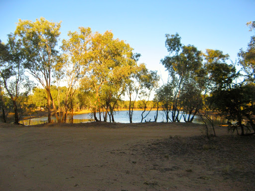
We motored on intending to get to our previous Laura River camp spot but we passed the Mary River rest area and popped in for a look. It was quite nice and not too many people there so we decided to stay.
Well we should have motored further on, by nightfall there were over 50 vans etc milling around and it became a bit of a caravan slum. We will never learn apparently.
19 Aug. our 42nd wedding anniversary
Now it's 9 am and I’ve glued and clamped the patch on to the water tank, 2 actually, a larger one over the top of a smaller one, (well it wouldn’t make much sense to do it the other way around) and the place is almost empty again.
The clamps will remain on the tank until I can get around to refitting it.
And so we bade farewell to the Mary River campsite, which actually looked quite nice after most caravans had left, and drove down to Halls Creek for a few bits of fruit shopping, then headed north towards Kununurra.
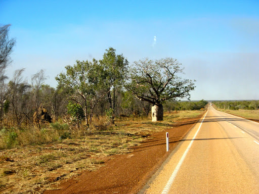
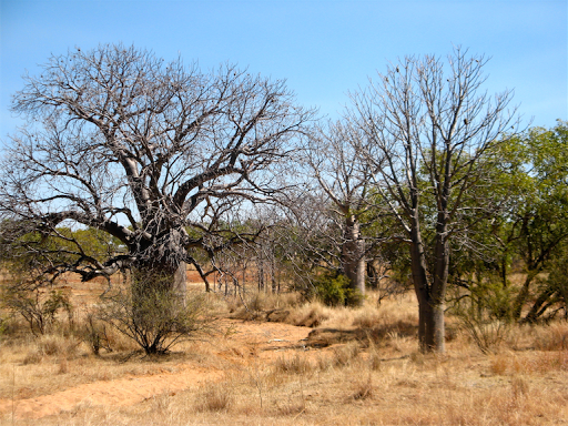
We stopped to look at some very pleasant groves of boabs growing along a creek line:
The scenery became quite pleasant with rolling hills and creeks with water in them, not unlike the Marble Bar region.
From a distance, this piece of tatty wire mesh on the old crossing looks just like a crocodile. Are we becoming paranoid?
Then we started seeing Fruit Fly Restriction signs for the Kununurra area, “No Stone or Citrus Fruit from April to December”. We hadn’t seen this restriction before so we are having mandarins and custard for dessert tonight.
A slithery moment
We were camped alongside the Warmun Creek this afternoon, sitting outside having a quiet beer when a long black snake, at least 20m long, but actually around 1.5m, slid along the edge of the grass towards us.
I involuntarily lifted my feet off the ground and said “Hey Janet”. She saw it at the same time and lifted her feet too. The snake must have sensed something, movement or vibration, and turned a sharp left into a clump of grass about 1 meter from us and shot off at alarming speed, leaving us to slowly regain our normal heart rates.
This a recreation of the exact same spot so we can avoid it next time:
Not sure what type it was, maybe a brown snake which lives in this part of the country and can be black in colour. Either way, not an animal to be trifled with until you know what type it is and even then, not to be trifled with.
When normal heart rates had been recovered, I erected a tall NextG antenna and got a reasonable service, enough to know what Clive Palmer was up to today, but the modem claimed to have a flat battery and kept turning off. It refused to charge and turned out to have an overheating battery so a few minutes in the fridge and all was OK again.
20 Aug. 42 years, one day and still going strong
Continued up the road towards Kununurra past many road work restrictions and single lane bridges. Started seeing pandanus palms along creek lines which now have water in them. And it’s getting decidedly hotter. However, my decision to blow out the stuff from my radiator seems to be paying off, the temperature doesn’t rise above 90º now with A/C on and with a hot engine, but Darwin conditions will test that theory.
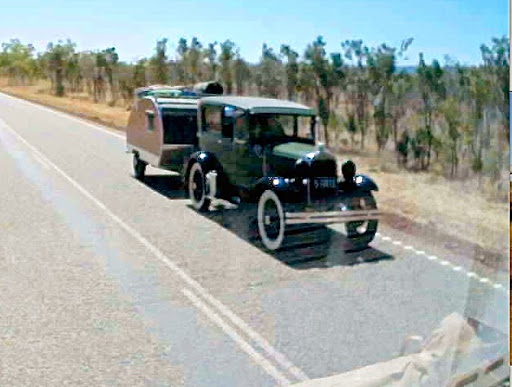
On the way we passed this very old car/caravan combination. It doesn’t seem the right sort of vehicle for these remote, hot outback roads, with 100’s km between service centres. Maybe cars (or their drivers) were built tough in the and 30’s and 40’s:
Tonight we are camped at an exclusive and free gravel scrape a few km west of Kununurra for a couple of days and I feel a rant coming on.
I don’t like Kuna much anymore, it seems a big hot dry dusty place now, not like the small green tropical oasis it used to be. We went to the Zebra Rock Gallery to feed the cat fish and be spat at by archer fish, but even that wasn’t as much fun as before.
There is still plenty of water about and big empty grassy areas but there are so many restrictions it makes one feel trapped.
We went to check out the Pump Station Restaurant where we had a good $20 night out with Charles and Fred a few years ago but that has gone downhill while the prices have gone up. $38-45 for a main course? Plus side dishes? That’s almost as much as a Big4 caravan park. I’m not being cheap but Value For Money is and always will be the criteria.
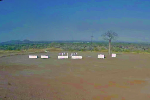
The ANZAC Hill memorial overlooking the Kununurra Valley is a sad place, just a few white concrete blocks scattered about the dusty ground, a boab tree and a bunch of flowers. No monuments or plaques of any kind. Maybe they’ve been taken away for restoration but there was nothing to suggest that, and the gates are still locked at night, to prevent what exactly?
We did do some washing and refilled the water tank in Kuna but fuel is $1.92/l so that’s not cheap either. Overall Broome was much nicer and much more economic.
We’ve done 1128km since leaving Broome with about 450km to go to Katherine and reasonable fuel cost again so I’ll need to put in a splash of fuel to get us there. Not many fuel stops between here and there (Timber Creek, Victoria River).
I’ve taken a happy pill now so everything will feel better soon.
Tomorrow morning while it’s still cool I have to refit the glued up water tanks and test it and on Friday we have booked a half day cruise on Lake Argyle with lunch thrown in ($95 each seemed reasonable although the concession was only about $5 less), before heading east into the NT.
21 Aug
The water tank is now refitted, not without some difficulty and a few swear words, but it’s now 3/4 full and it seems to be holding water.
Janet had another wildlife scare when she nearly trod on a land crab. They are supposed to hibernate in deep mud until the rains come but this one got woken up too early.

We bought a few items in Coles, got our fuel 4c off and came up to the Swim/Ski Beach for lunch.
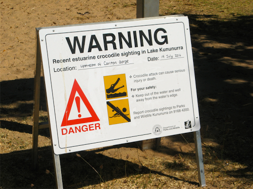
The last estuarine crocodile sighting in Lake Kununurra was 14 July, like only a month ago, so the Swim/Ski Beach may have to be renamed.
A dragon tree near the Kununurra Swim Beach. The only other dragon trees we’ve seen were in the middle of a desert:
After lunch we were sitting around, in between float planes taking off and wondering what to do when we had an idea. Instead of our exclusive and free gravel scrape campsite tonight, why not drive up to Lake Argyle and stay in the caravan park there where we will be nice and early for our cruise in the morning. And so we did.
It’s a 1 hour, 70km drive to the “resort” and it was very crowded when we got there but they had plenty of space as long as you weren’t waiting in line behind 6 camper trailers all wanting to camp together, which of course we were.
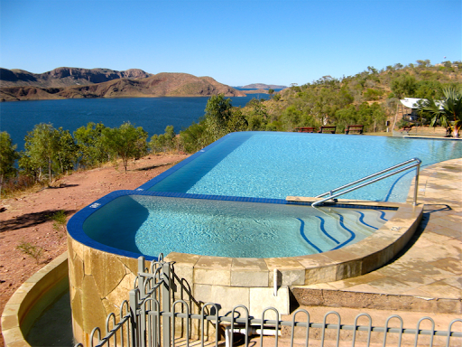
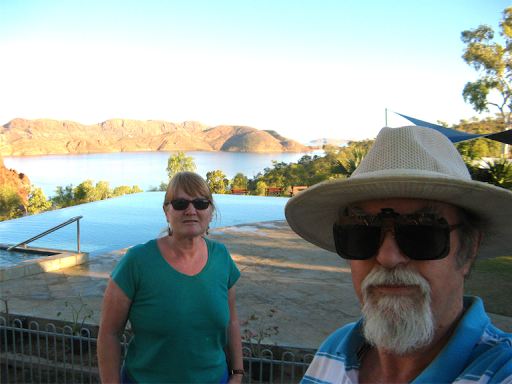
However our simple needs took precedence and for $30 (not too unreasonable) we soon got an unpowered site in what turned out to be one of the most spectacular caravan parks we’ve been to.
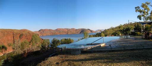
The views over Lake Argyle were stunning, as was the “water to the rim” swimming pool. Apparently voted the most stunning pool in Australia, and I want one, especially with that view.
A helicopter was on standby in case anyone needed a sunset cruise over the lake. No doubt he’ll be up with the larks at 6 am tomorrow morning as well.

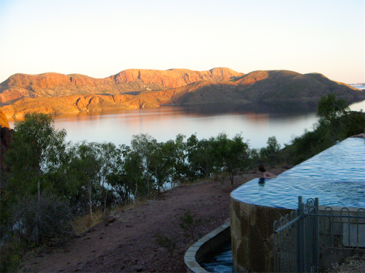
Sunset over Lake Argyle
22 Aug
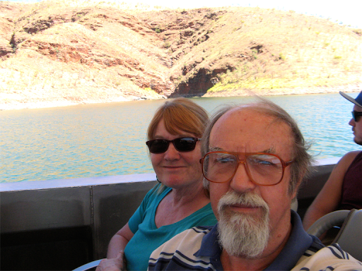
Early morning cruise today, preceded by a very interesting 1 hour video on the construction of the Ord River dam and its infrastructure, but not before bacon, eggs and tomato for breakfast, with bacon(!!).
The cruise was much, much more interesting than we had anticipated with a very well informed and almost continuous presentation from a young Kiwi, Josh from just north of Wellington with a PhD in Australian Raptors.
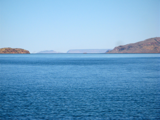
The lake looks big on the map but it’s not until you get down to it that you realise just how big it actually is, 70km long, 35km wide and up to 44 meters deep (today), there are parts where you can’t see the hills on the far horizon and the views are, well, stunning.
Here’s our cruise in pictures:
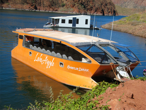
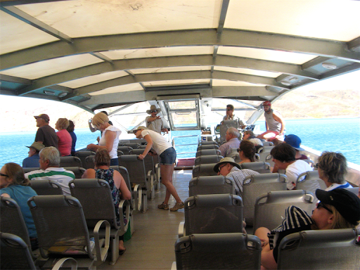
This is our cruise liner, 50 seater, all aluminium catamaran, with powerful twin Cummins diesels, although there were only around 25 persons on board for our cruise today. It was named the Kimberley Durack, (the grandson of Patsy Durack who first acquired the land in the 1870’s) who saw the benefits of damming the Ord but sadly didn’t live to see his vision completed.
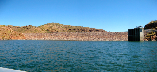
The dam wall took 3 dry seasons to construct and is made of compressed clay with a rock protective covering. It’s very small considering the vast volume of water it’s holding back (18 to 70 times as big as Sydney Harbour, depending on the wet season variations). Currently the lake area is more than 1,000 sq km (up to 2,000 sq km in the wet season and can be 9m higher than the current water level). It was anticipated to fill in 7 to 8 years but actually only took 3 years.
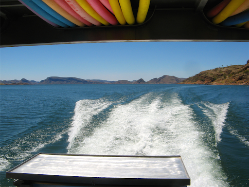
Cruising at 40 kph:
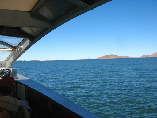
The size of the lake becomes apparent as we rounded the local islands and headed out across the lake:
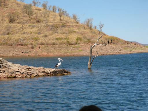
We passed pelicans and black cormorants:
At least Janet wasn’t sick, the lake was flat today but the waves can reach 3m during wet season storms:
The boat cabin was spacious and light with no windows to block our view (fully air-conditioned and it was pleasantly cool).
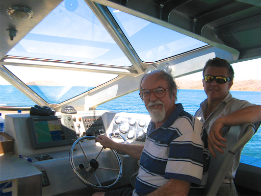
I took a turn driving the boat while we were doing a pedestrian 17kph between islands (but our moving map display is bigger than Captain Jack’s):
The end of the lake is 50km away and over the horizon:
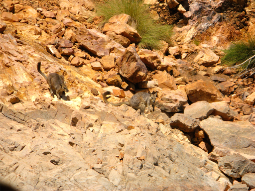
We stopped off at a large island where local wallaroos had been relocated to by environmentalists Harry Butler and Malcolm Douglas in the early 1970’s as the lake filled.
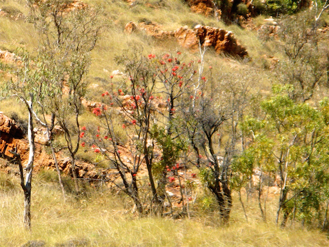
A nearby “Kimberley Rose”, a pretty small tree with sticky red flowers on it:
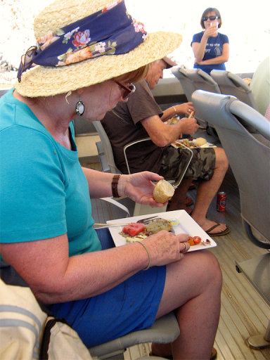
Later we stopped on a beach on an island for lunch and an optional swim:
You’d think we were cruising a major ocean.
Lunch was BBQ’d Silver Cobbler, a large tasty catfish variety from the lake (which is highly sought after in Perth fish markets) plus chicken, ham and salad, with beer or wine:
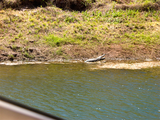
On the way back (and after the swim, lest anyone be scared witless), we visited a section of the lake shore where freshwater crocodiles nest. There were an estimated 25,000 freshies in the lake at the last survey, but fortunately no salties (as yet discovered):
The flat-topped Argyle diamond mine is visible 35km away to the west:
Downstream from the dam is a hydro power system which supplies Kununurra, Wyndham and the Argyle Diamond mine with environmentally friendly power: This is also the Ord river which is dammed again in Kununurra (by the diversion dam) as a water supply. Overall, the original flows of the Ord have been maintained, despite having created the largest freshwater lake in Australia.

This Ord river tributary which is now a spillway exit for the lake still flows with its original flows although it’s fairly low in the dry season:
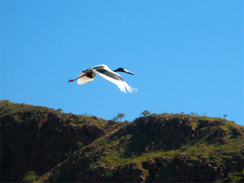
Crossing the Ord River I saw a beautiful Jabiru Stork (now boringly called a Black Necked Stork):
This cruise was one of the best experiences we’ve had in a long time. We been to Lake Argyle several times before but never had a cruise before. Janet takes all the credit for the idea but I take the credit for turning it into an anniversary pressie.
Warning political rant follows:
Overall, the statistics of Lake Argyle are mind boggling, or at least mine was boggled. And ultimately made me sad but mad.
1000 sq km surface area, evaporation rate of 200,000 l per day, and enough water annually to supply all of Australia’s water requirements many times over. The peak flow rate in the 2011 wet season was the second highest in the world after the Amazon, measured in millions of gigalitres per second. During March 2011, they received 1400mm of rain in 3 weeks in the catchment area.
But the area under irrigation is actually relatively small, 12,000 hectares and most of this is now used for growing Indian Sandalwood for a Chinese company. Why? That was never the original intention. So after all this work and expense, very little is actually used for growing crops for Australians and worst of all, almost all the Ord’s water still flows into the Indian Ocean at Wyndham.
Same old sad story, lots of resources but in the wrong place. Plenty of water here but it’s needed down south. Plenty of solar energy in the centre but the consumers are all down south. The WA minister who dreamt up a canal from the Kimberley to Perth got the idea right but the technology lags behind. Shipping solar energy (electricity or something made with it) to major cities down south should be quite possible.
It’s not rocket science, it just takes governmental guts and determination, not piddling around with parental leave schemes which generates no benefit. A 500km water pipeline from Perth to Kalgoorlie was installed in the 1880’s. The engineer was hounded into suicide by opposition doubters but the pipeline was built and is still in use today. The Snowy Mountain scheme of the 1950’s reversed river flows to irrigate the inland of NSW, so all things are possible. Currently we can ship thousands of tonnes of live beef, iron ore and natural gas around the world but can’t ship a few litres of water a few km south. Instead we spend $billions on desalination plants.
This one touristy cruise has opened my eyes to the total stupidity and lack of vision of our governments, of all persuasions. I would happily give back my $550 (if I ever got it) from the carbon tax if I could see something worthwhile being implemented, but sadly I’m reminded of dead horses and how it’s a waste of time to flog them.
The words “Government” and “long term vision” can no longer be used in the same sentence.
End of rant.
This afternoon we left Lake Argyle and headed into the NT, only a few km east but 1 1/2 hours ahead in time, to camp in the Keep River National Park at the Gurranldalgn campground.
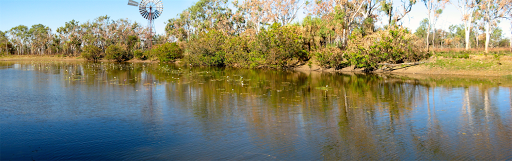
But first we called in at the Ranger Station at Cockatoo Lagoon for a quick look. It seems to have a bit more water in this year and looks as pretty as ever:
23 Aug
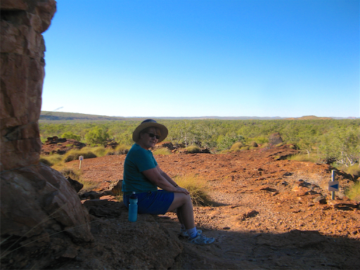
At first light (plus a bit) we did a very nice 2km walk over the Gurranldalgn hills, one we’ve done twice before but it’s very picturesque.
It was quite nice to find some cool shade even at 8am:
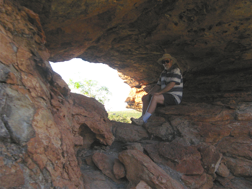
And a shady hole in the rock. I bet no one has ever had their photo taken here before:
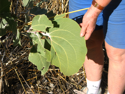
A large “leaf” from an Acacia Dunnii. Actually we discovered that acacia leaves are not true leaves at all but flattened stems painted green, which accounts for the fact that veins in acacia leaves run parallel to the stem, not across like most leaves.
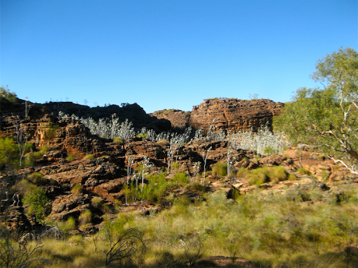
The view from the escarpment in the early morning sun was spectacular and looks like a mini Bungle Bungles:

A bank of silver leafed acacias agains the rock wall:
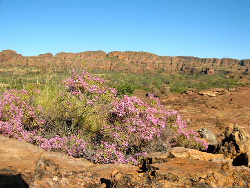
A very pretty but unidentified mauvey-pink bush with a magnificent backdrop:
After our walk we left the Keep River National Park, at least as far and the entrance track where I stopped to grease the clutch release bearing which had started squealing. Much better now.
We then drove down the monotonous mostly burnt out highway towards Timber Creek. About 20km west of TC is the Gregory Tree, a large Boab alongside the Victoria River (a major crocodile river) blazed by Gregory and his mates in 1856. He named Timber Creek since it was the best location for acquiring timber for boat building.
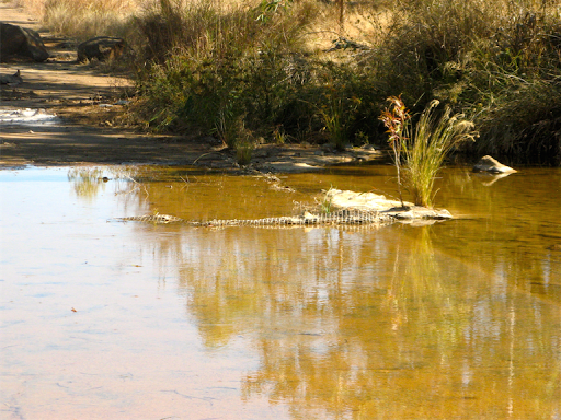
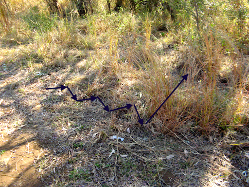
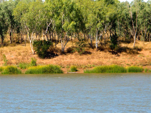
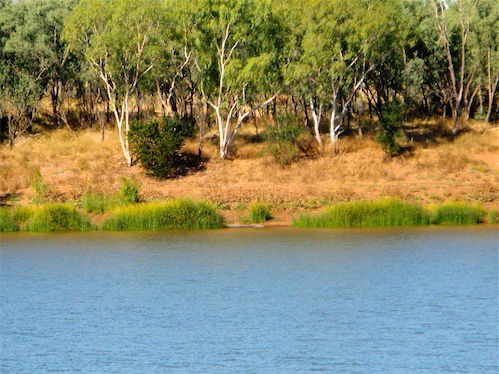
We stopped to look at the 200m wide Victoria River and all looked pleasant and calm until I blew up some pictures from the opposite bank.
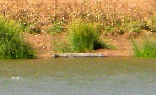
These “logs” on the far bank have changed places in the space of about 1/2 hour.
A blown up section but you can see the head on the right and the curled around tail on the left.
We are camped overlooking this spot on the nearside bank but at least 100m from the water’s edge and 10m up on an embankment. We had a close encounter with a croc a few years ago on the Mary River east of Darwin and have no wish to repeat the experience.
We did have a visit from a couple of kangaroos though.

Tomorrow we strike out for Katherine.
24 Aug
Before striking out for Katherine, we thought we should actually have another look at the Gregory Tree which was the purpose of our side trip anyway.
Augustus Gregory was tasked in 1855/6 to determine if claims of good cattle grazing country in the north of Northern Australia were true (which he did and they were)
The nearby township of Timber Creek was established and named by Gregory as a source of good timber, surprisingly enough.
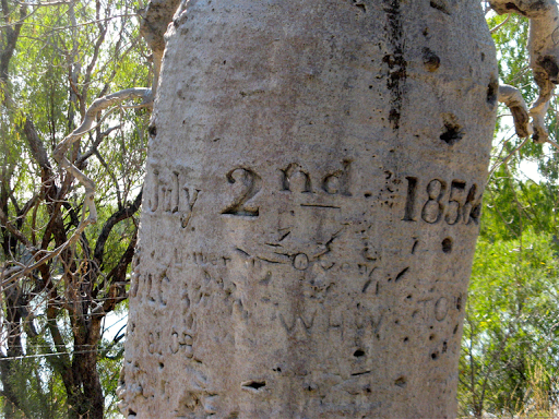
He established a base camp on the Victoria River and his artist, Thomas Baines, inscribed this then much smaller boab tree with details of the expedition’s progress, including the date July 2nd 1856.
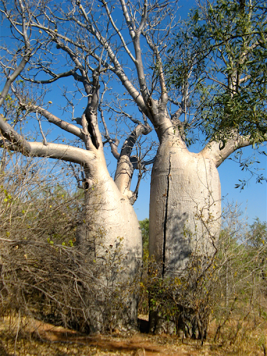
These twin boabs were also referred to in Baines writings as a direction pointer to the camp. Janet wee’d behind them, or was about to when some other tourists appeared and curtailed the process.
On the way back we spied this northern rosella in a boab tree with some boab nuts (all parts of which are edible):

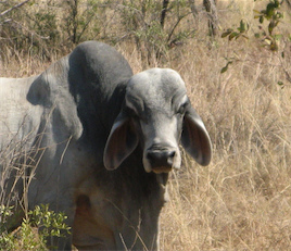
Does this bull’s face (on a neighbouring station) remind you of something out of Star Wars?
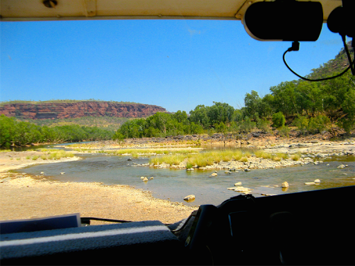
Leaving such imponderables behind us we continued east to where the Victoria River become narrower and shallower, to where an early causeway had been built.
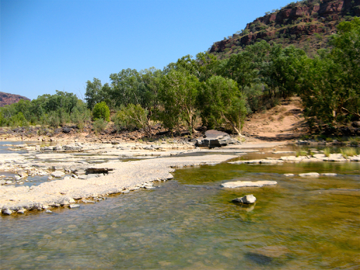
Not a bad lunch spot?
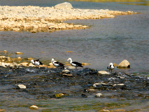
Radjah Shelducks were foraging in the shallows:
The old causeway is looking in a sad state after 100 years of wet season’s raging torrents:
We reached Manbulloo Station Stay, just west of Katherine at 4pm after 1600km and 7 days from Broome, for a couple of days maintenance and shopping before heading north to Darwin.
5600km completed so far on this trek, about 3500km to go.
25 Aug
Had a lazy morning so far, managed to access the internet for what to do in Darwin that we haven’t already done.
A day trip to the Tiwi Islands seemed like a good idea but when I searched for info all I got were confusing and misleading stuff about Aboriginal Tours (the only kind you can get and need a permit to visit anyway), and nowhere to book an economical tour ($250 by ferry or $450 by air, each) either. So I looked at Trip Advisor and all the comments were negative, waste of a day, no culture (no dancing, no art sites, no scenery etc), all time spent in one arts place, childish paintings, expensive arts, money, money, money etc and basically waste of time and money.
So that’s off the agenda, in favour of a $30 per 24 hours hop on-hop off double decker bus tour. It got tons of good reviews, even though we’ve done most of the places before, not having to drive, park, walk about in the heat seems a more and more attractive option.
In the afternoon we went shopping in Katherine for food, fuel and gas, all successfully, plus Janet bought some shorts in Rockmans as she always does. It was stinking hot but the counter girl in Rockmans was wearing jeans, a long jumper and a woolly scarf and still complained of feeling cold. Must have had hypothermia or ebola or something else exotic.
Follow the other sections of our 2014 trek here:
No comments:
Post a Comment